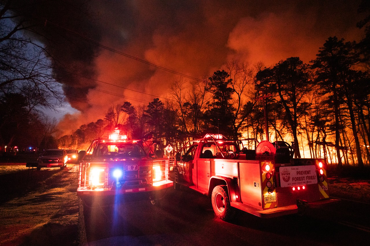
🔥 Current Wildfire Snapshot (As of April 22, 2025 – 10 PM)
Name: Jones Road Wildfire
Location: Greenwood Forest Wildlife Management Area
Towns Affected: Barnegat, Ocean (Waretown), and Lacey
Acres Burned: 3,200
Containment: 5%
Structures at Risk: 1,320
Residents Evacuated: Over 3,000
Cause: Under investigation
Winds: 15–20 mph, westward
🗺️ Affected Areas & Evacuations
🔴 Mandatory Evacuations
Wells Mills Road, Ocean Township – From Bryant Rd to Garden State Parkway
Route 9, Lacey Township – Areas adjacent to the fire’s northern progression
🟠 Voluntary Evacuations (Barnegat Township):
Windward
Mirage
Pheasant Run
Heritage Point North
Brookville
West Bay Avenue Corridor
Local officials urge residents in voluntary zones to prepare for rapid evacuation should wind shifts change the fire's direction.
🚧 Road Closures
Road | Status |
|---|---|
Garden State Parkway | Closed both directions, Exit 63 to 80 |
Route 532 (Wells Mills Rd) | Closed from Route 72 to Garden State Pkwy |
Bryant Road | Closed between Wells Mills Rd & Route 539 |
Jones Road | Closed between Route 532 and Bryant Rd |
Route 9 | Sectional closures near fire line |
Expect detours and do not attempt to bypass barricades—you may interfere with fire suppression crews or endanger yourself.
🚒 Containment Efforts
As of 8:00 PM, containment remains limited at 5%, due to:
Dry pine forest fuel
Winds pushing the blaze east and north
Firefighting Strategies:
Air Tanker Drops: Tanker 81 and a 300-gallon helicopter are actively dumping water and fire retardant
Ground Crews: Bulldozers and hose lines are establishing fire breaks
Backfiring Operations: Controlled burns are being used to cut off fuel ahead of the blaze
Incident Command Post: Operating from Wells Mills Park, with unified coordination between NJ Forest Fire Service and local fire departments
Hundreds of personnel from across Ocean County are engaged in a coordinated containment effort. Power lines have been deactivated in key areas to allow safe aerial and ground response.
🏠 Emergency Shelter & Relief Support
✅ Primary Shelter (Pet-Friendly):
Southern Regional High School
📍 90 Cedar Bridge Rd, Manahawkin, NJ
Provides cots, food, medical aid, and pet accommodation
Staffed by Red Cross volunteers and local officials
If you are displaced or unsure whether to evacuate, this is your first stop. The shelter is open 24/7 as long as evacuation orders remain in effect.
⚡ Power Outages
Jersey Central Power & Light shut down circuits near the fire zone affecting over 25,000 residents across Barnegat, Lacey, and Waretown. Crews are working to restore service once safe. Residents should be prepared for extended outages—charge devices and stock flashlights and batteries.
🆘 How to Get Help or Contribute
Organizations Supporting Relief Efforts:
Organization | What They Do | Contact / Donate |
|---|---|---|
American Red Cross NJ | Shelter, food, emotional support | redcross.org or 1-800-RED-CROSS |
Ocean County OEM | Emergency coordination, shelter logistics | 📞 732-341-3451 / [email protected] |
Salvation Army Disaster Services | Food, water, and temporary housing | |
Local Fire Departments (Barnegat, Lacey, Waretown) | On-scene firefighting & animal evacuations | Accepting water/snack donations locally |
Popcorn Park Animal Refuge | Taking in pets of evacuees |
If you want to help:
Donate to verified charities
Share accurate information via social media
Avoid the area to keep roads clear for emergency response
📢 Stay Informed
Stay up to date with trusted, real-time sources:
NJ Forest Fire Service: NJFFS Website
Ocean County Sheriff’s Office: Facebook / Twitter
News12 New Jersey & NJ.com: Real-time alerts
X (Twitter): @LakewoodScoop, @NJForestFire, @OCSheriff
🚨 Final Thoughts
The Jones Road Wildfire is one of the most aggressive wildfires in recent New Jersey memory—growing from 150 to 3,200 acres in less than 12 hours. While firefighters are making progress, this emergency is far from over. Whether you're a resident, real estate professional, or a concerned neighbor, now’s the time to:
Prepare or execute evacuation plans
Check on vulnerable friends, family, or clients
Support local relief efforts with your time or donations
As this story develops, we'll continue to provide updates right here. In the meantime, stay safe, stay informed, and stay ready.